Today, I will start with a map and a quick listing
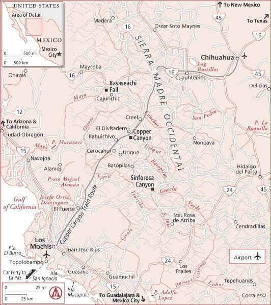
Today, i'll start with a map and a quick listing of the bigger towns in the area, most of the dirt roads on the region connect this towns, some are well known but most of the new ones are not in maps yet.
I will cover only the roads north of El Fuerte, you can certainly go up the sierras from Culiacan and Guasave/Sinaloa de leyva but its considered risky and I woudn´t recommend it.
Lets start ...
There are 3 main routes up the sierras, I will describe them in detail in the coming days, for now lets just do a quick list of each one.
Route A : LOS MOCHIS-EL FUERTE-CHOIX-TUBARES-PIEDRAS VERDES-MESA DE ARTURO-CEROCAHUI-BAHUCHIVO-CUITECO-SAN RAFAEL-DIVISADERO-CREEL.
Route B: ALAMOS-SAN BERNARDO-CHINIPAS-TEMORIS-MESA COLORADA-BAHUCHIVO-CUITECO-SAN RAFAEL-DIVISADERO-CREEL.
Route C: OBREGON-YECORA-BASASEACHI-SAN JUANITO-CREEL.
You will notice that some well known places are not on the routes, like Batopilas or Urique, I will get to them later on, after I describe the above routes in detail.
Saludos
entrada de efuentes @ 8:00
1 comentarios
![]()


1 comentarios:
Great idea Edmundo, looking forward to reading the details and the maps...hope the info I provided via email helps you out...thank again, Jan
Publicar un comentario
Suscribirse a Enviar comentarios [Atom]
<< Inicio