jueves, 31 de enero de 2008

All the weather at Copper Canyon Gate ...

Today´s blog will hold the weather for the several towns of the region, by Accuweather.

I put a permanent link to this blog on the sidebar for future reference, I hope its usefull.

If you need any other place, leave a comment please.


Enjoy.

Etiquetas:

martes, 29 de enero de 2008

The Silver Trail - El Camino de la Plata


I found out about an interesting Eco-Tourist project in the area, a bunch of guys are trying to resurrect the original trail of the mule trains that were used to transport silver from Batopilas to Chihuahua and turn it into a MTB and backpacking trail.


Proyecto Eco Turístico
Camino de Plata - Silver Trail

Etiquetas:

lunes, 28 de enero de 2008

There are some good days... And some Bad ones :-(

As I was getting ready to fix some things for my car on Saturday, a friend asked me to help him move some stuff off his trailer, he picked me up and off we went to a Taller (Workshop).

We were trying to get a heavy differential off the trailer, when a guy decided to help and grabbed a brake line and start pulling it, of course the line broke free and despite my Homer Simpson, Cat like reflexes, it struck my face really close to my right eye. So I spend the afternoon with doctors checking if everything was all right (which it was fortunately). so besides a black eye and a cut in the nose and the forehead looks like I will be wheeling again soon.

Being a firm believer of Murphy's law, it struck later that day, I was the only one without the flu at my house, so my body decided to give it a try.

So, I´m here, sitting at my home computer, sick as a dog and with a black eye. At least I have been doing a lot of web wheeling to get by.

Check the Vodka driven, crazy Polish guys doing an impossible fun trip. (Some foul language, caution)

3 KTMs go East @ advrider.com

Saludos

Etiquetas:

sábado, 26 de enero de 2008

The nice One ... El Fuerte - Tubares - San Juanito


We finally got a hold of a great GPS route, from El Fuerte to Tubares to San Juanito, as usual click the linky, hope you enjoy it.

For me its the best route to take from Los Mochis to Creel, the views of Presa Huites, crossing El Rio Fuerte, plus the steep Tubares - Piedras Verdes Trail makes a winner, it also includes the backroad to Urique.

For the .klm file you should have Google Earth installed, and remember the .gpx Garmin file is inside a .zip Archive.

Its a big file, so be patient.

.kml and .gdb files at keyhole.com


Saludos and Enjoy

Etiquetas: , ,

jueves, 24 de enero de 2008

The Mini Blogger ...

So much for being the lone blogger in the house, as of today my kid has decided to start helping :-).

The first two blogs ...

How do you feel when you write in english?

When I write in English I feel a lot of wonderful but very awkward emotions. The first thing I feel is a bit of accomplishment because I spent a whole year learning it, and I have to admit it wasn't easy. I also feel really good thinking that my parents would be very proud if they saw me writing in English, like their kid just grew up. But then I feel like if I were leaving something behind, my whole childhood, my parents, my traditions, my hometown, even myself. But then just before I fall apart I can somehow look up and I see myself in the future, with a good job and a big happy family, and all thanks to my english. But suddenly I come back to me and I realize that I'm just writing in English. What a big deal.

My trip to Las Copas

Right now is 9:27 pm, and today is Sunday. A few hours ago I was waking up (at 7:00 a.m.) and getting ready to make an awesome trip, a trip that only a few have been able to do.

Around 7:45 a.m. me and my dad were heading to the funeral chapels Las Misiones (Don’t worry, no one died, that is our meeting spot because the brothers that own it were also going to the trip) and as usual, nobody was there. By 8:15 a.m. Enrique and Mauricio appeared but we were still waiting for Mike and his son & crew. My dad, Enrique and Mauricio are “Jeeperos”, and all it means is that they ride in Jeeps that are modified to be able to go off-road, but not only off-road, extreme 4x4. But Mike is another different story. Mike and my dad are really good friends, but Mike rides ATVs, so my dad invited Mike and his son & crew to our trip, so they could ride the sand dunes in Las Copas.

By 8:30 a.m. everyone was ready and we started our journey. We stopped for Gas and batteries for our walkie-talkies while Mauricio was buying his beer. We took the highway to Culiacán and rode for about 20~30 minutes, which was the most boring part of the trip. We rode until we reached the road to El Cerro Cabezón (In Spanish “cerro” is a mountain and “cabezon” means big headed, El Cerro Cabezon is a mountain with the shape of a big head) and we rode that way. But before that we stopped a little bit to turn on the 4x4 on the Jeeps and to get the ATVs down from the tow (ATVs are really fast, but not fast enough to ride on the highway).

We reached a small village called El Carrisito, (from what we had researched, the trail to Las Copas was closed by a gate with a lock) and in there we looked for the Comisario (like the village mayor, who was an Indian about 50 years old). My dad talked to him and told him that we were doing, who we were and where we were from, and he agreed to open the gate for us. (he explained that there was a gate because of hunters. There are lots of deer in that zone).
So basically, our journey has just started, the trail became really though and rocky. We rode that way for around one hour until we reached the most critical part of the journey. The reason that nobody goes to Las Copas in cars is because there is no trail beyond the part we were about to cross. Also, there are few times in the year when you can cross the valley that divides Las Copas from the rest. That valley is flooded with sea water so only during winter the sea levels are low enough to cross the valley, but still, it isn’t easy.

Before crossing it we did some math, we had from ~10:00 a.m. to ~4:00 p.m. to cross, get to Las Copas, enjoy it, take pictures and then come back, and if we took longer, the sea levels would rise again and we would have had to wait until the next day. But we didn’t think about it twice, we stepped on the gas pedal and cross the muddy valley. For us in the trucks was though but comfortable, but for those in the ATVs was way easier (since ATVs aren’t as heavy as trucks, they don’t sink that much) but they got covered in mud, and it was only the beginning.

After we crossed it, we rode for a while until we found a really cool cavern, we got inside (by foot) joked around and took pictures, that cavern was amazing. We took a 30 minutes break in there and then we resumed our trip. We rode for a while again until we finally got there. From the beach you could see El Maviri Beach and Topolobampo Port.

By then we were done with our goal, but we kept riding a little more until we got around the tip of Las Copas and we found something very interesting. We found a lake like thing behind the beach, and there were some fisherman in there. They were astonished to see us because it is the most uncommon thing to see in Las Copas, cars. But those were not common fisherman, they didn’t actually fish, what they did was grow oysters. They had an oyster farm, and I believe it’s the first one in the region. We talked to the fisherman there and they told us that every oyster was “planted”. The oysters are put in some bag-like containers and sunk in the water. Every “seed” is like a baby oyster produced in a laboratory in La Paz. Every million seeds costs $45’000.00 pesos, so it’s some serious business. From what we talked to the fisherman, we learned that every oyster takes around 8 months to grow up enough to be sold and eaten. Coincidentally, the boss in there was Beto’s uncle (Beto is an old friend of the Jeeperos, actually, he was the mechanic in the crew, but he moved out of town), so he led us try some off the bigger oysters. They were delicious.

On the way back two of the ATV’s tires flattened out and we had to fix them, then the gasoline container fell and spilled so we had to pray we didn’t run out of gas. Fortunately we managed to get to El Carrisito safely and from there we took the highway to Los Mochis. The trip is a one-of-a-lifetime. I would recommend anyone to take the journey.

Etiquetas:

miércoles, 23 de enero de 2008

Not all the scenery its at the mountains !!!


I like living in Los Mochis because I can get to the mountains in a couple of hours, but a nice thing is that I can also get to the beach in a hurry, last weekend we did a route that took us a long time to archive, we call it Los Mochis to Las Copas, and for us its a classic.

The route took us across the big Ohuira Bay and to a place that never get visited by vehicles, I really like the look on fisherman when they see our cars :-)

We also cross a Campo Pesquero that sits at the original landing place of the Owen Expedition of the late 1800s, so all an all a nice daytrip with some very good friends.

I hope you enjoy the journey.

Etiquetas:

lunes, 21 de enero de 2008

The first try at GPS tracks and Routes.


I haven't been able to post lately since i have been preparing the first GPS tracks that some people have asked me about.

I will post two different type of Tracks, for Garmin GPSs and .kml files for using on Google Earth,

This its the first try at a .kml (Google Earth File), You should have Google Earth installed or use the Google Maps option.

Its a 8 MB file, so be patient.

.kml and .gdb files at keyhole.com


Saludos and Enjoy.

Etiquetas:

miércoles, 16 de enero de 2008

Across a big river and up a big mountain; The tale of La Ruta de la Independencia Part 5

And then, on the last day, we rode ...


And rode ...


And rode ...


And rode ...


And finally, Success !!!

Basaseachi Falls, all 650+ feet of it ..

The dirt road up to Basaseachi was very nice, for me one of the best in the whole area, its being paved with maybe 20% ready, i have mixed feelings about the improvement, i think i will be good for the communities, specialy during the harsh winters, but i cant stop feeling that we are losing one of the ´Great Ones´


Yecora at Dusk, sadly the end of the big group. From there we took the road back to our hometown.


The Official Route Map, not the most detailed map, but its good to give you and idea of the B route.


This trip, with more than 60 cars, was very different from what I am used to, I think that the way we divided the group was a good thing, and made everything more manageable.

Despite the problems at the Chinipas river crossing, I still think that Mid September its the best date to visit the Sierra in a 4x4, with the rains making for a nice expedition feeling to it, I hope you enjoyed the photos and will be waiting for your comments.

Saludos.

Etiquetas:

martes, 15 de enero de 2008

Across a big river and up a big mountain; The tale of La Ruta de la Independencia Part 4

Finally, we made it to Creel ...

Since we where there, we had to check out the bar with the live Bengal Lions at the door, sadly after that and way too many beers everything its kind of blurry .. So not much to tell ...

Whats left of the crew. It was later on the day declared the official Hangover day


On the way to Basaseachi, and the rain began ...


If you can only take two roads on the Copper Canyon, take the Cuiteco lower road and this one ...


Next, the conclusion and goodbyes

Etiquetas:

lunes, 14 de enero de 2008

Across a big river and up a big mountain; The tale of La Ruta de la Independencia Part 3

And on we went to Cuiteco, crossing Bahuchivo, taking the lower dirt road.

A nice day to wheel with your friends.


The Friendly Mexican Ejercito. Doing a hard and underfunded job.


When you see the railroad it only means you are getting closer to somewhere.


Our Tijuana friends, a diesel van sure comes handy when you have to pull a JK across the sierra.


Toño, our Navojoa Main man, showing us how not to get close to the Cuiteco Creek fall.


The Cuiteco Lower road, if you can only ride on one road in the copper canyon, make sure its this one


Etiquetas:

domingo, 13 de enero de 2008

Across a big river and up a big mountain; The tale of La Ruta de la Independencia Part 2

Whatever relief we felt for crossing the river soon ended, as we realized that we had to drive 3 or 4 hours in the dark and under a heavy downpour to get to Temoris, were we decided to spend the night.

But first, Chinipas, the forgotten, middle of nowhere, last century mining Mecca.


For a while there where the not so menacing little clouds.


And all smiles and even a rainbow shot.


But then, the smiles disappeared. Beautiful and scary, my best two words to describe the drive up to Temoris.


The next day at Temoris, accounting the damages. And educating the rear fenders not to mess with my new tires.


Another day at the wheel, on route to Cuiteco.


Next, the nice road ...

Etiquetas:

sábado, 12 de enero de 2008

Across a big river and up a big mountain; The tale of La Ruta de la Independencia

Some time ago we setup for our annual trip up the Tarahumaran sierras in the Copper Canyon area, but this time somebody decided to do an open invitation to the nearby 4x4 clubs, little did we knew that we`ll end with a nice and long line of more than 60 cars....

Our trip consisted this year of a long drive starting in Navojoa then to Alamos, across the Chinipas river, up to Temoris, cross the nice towns of Cuiteco and Divisadero, Then Creel, across the sierra to the nice Basaseachi Falls, back to Yecora and from there by road to our hometowns, all and all almost a thousand miles of mostly rugged roads and nice postcard worthy vistas.

The get together at Navojoa, after a nice Cochito a la cubana (Cuban style Pork barbecue) and plenty of beer. As a good Mexican i am a sucker for stickers ... :-)


At 6.30 am we headed out of town, on our way to Alamos, Sonora. We divided the big group in 4 groups or so, and off we went.


Alamos, a good old fashion colonial town (With some good restaurants), I am partial to El Fuerte, Sinaloa. But still like Alamos a lot .


Up the sierras on our way to destiny (The Chinipas River crossing)


After several hours, getting closer to the Chinipas River, down below.


With the help of our river guide we mostly make it across (For the record, out of almost 60 cars, only 5 had trouble, and of those, 4 where brand new JKs), so much for new tech.


This its what a heroe looks like deep in the Sierra, our trusty river guide (He made a killing that day, $5 per car )


Next, the big dark road ahead ...

Etiquetas:

viernes, 11 de enero de 2008

Our annual big trip, La Ruta de la Independencia 2007


Our annual trip to la sierra this past september was a great success with over 60 cars from several 4x4 clubs.

We took route B to Creel and then went on to Basaseachi falls, it was great to travel with so many people, and the Montañas where nice as always.

Read on to see what a bunch of guys on 4x4s did last september ...

Etiquetas:

Nice contributions by a friend.

My friend Jan Alsen just send me some nice info on the different canyon systems around the area, i hope you enjoy it.

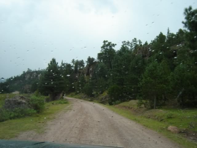
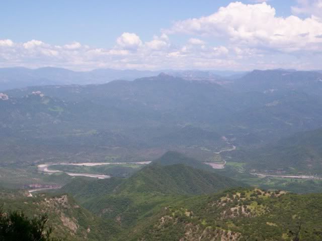
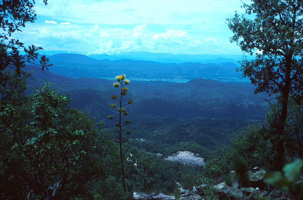
Some of the major Canyons of the Sierra Madre

Urique Canyon
- accessible via country highway from the town of Creel, - the gateway to the Copper Canyon
- deepest canyon of the system
- excellent vantage points at Divisadero (good vistas), the Mesa de Arturo and the Cerro del Gallo, near the valley village of Cerocahui - accessible by dirt road from the Bahuichivo train station,
- visit the Misión San Francisco Javier de Cerocahui and take a walk up to the Yepáravo and El Salto waterfalls nearby.
- thermal hot springs at La Huerta, as well as wonderful Bisabirachi rock formations and the Chomachi cave paintings near the town of San Ignacio de Arareko. At Lake Arareko, too, are camping and light boating facilities.
- most visited waterfall, the 30 meter high Cusárare Falls, is accessible from the town of the same name along a good path. The Rukiraso, also 30 ft in height, is located 10 km from Creel in the Tararecua Canyon, which joins the Urique. It can be reached by vehicle

Sinforosa Canyon
- Accessible by road from Creel or Parral, Sinforosa Canyon, called the "Queen of the Canyons", offers breathtaking natural scenery on all sides from several fabulous vantage points. There are a number of Tarahumara caves to visit, and many waterfalls with drops of between 5 and 80 meters, the tallest being the Rosalinda. These falls and caves are accessible via walking trails. Thermal waters spring from the earth at Agua Caliente (Aboreachi) and Esmeralda, on the Nonoava river.

Batopilas Canyon
- accessed by road from Creel or from Guachochi. Taking the Samachique turnoff, it is then a 55 km trip winding down into the depths of the chasm - it takes about 3 hours to cover that distance. - From La Bufa overlook along the route, one has a view down 1,300 meters to the town of Batopilas and the La Bufa mine.
- greatest history of silver mining. The mining towns nestled in its depths are its main attraction, and include the towns of Batopilas and Cerro Colorado.
- interesting architectural productions of the mining era such as the San Miguel Hacienda, the Temple of the Virgin of Carmen, Casa Barffuson, Casa Bigleer and Casa Morales, as well as the Sor Juana Inés School
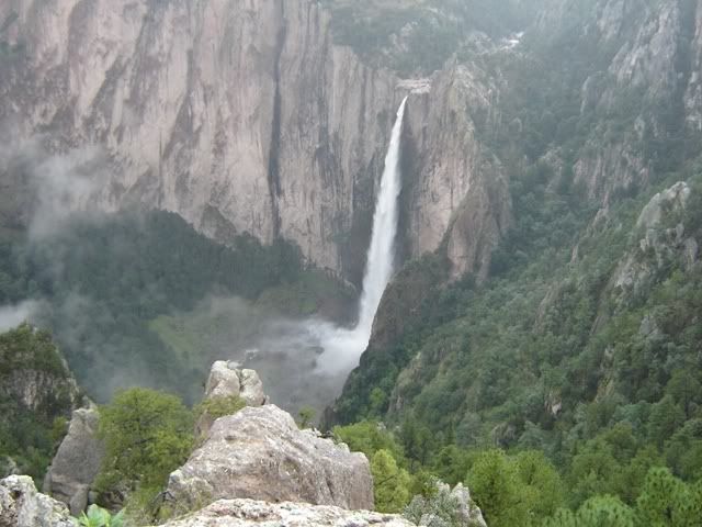
Candameña Canyon
-main attractions are the Basaseachi and Piedra Volada Falls. The small community of Basaseachi is located about 280 km. west of Chihuahua and is accessible via road along the highway to Hermosillo.

At the head of Candameña Canyon, Basaseachi Falls, with a drop of 246 meters and located within Basaseachi National Park, can be viewed from several vantage points along the walking trail. A somewhat difficult path leads to the Piedra Volada lookout, from whence you are afforded a spectacular view of the deep, narrow chasm and are faced with a great wall of stone called El Gigante. It is the highest vertical rock face in the country, dropping a straight 885 meters to the Candameña River at its base.

Piedra Volada Falls drop an incredible 453 meters, and was only recently discovered in 1995. It is the largest falls of the Copper Canyon System. If you want to see Piedra Volada Falls at its best, visit it at the end of the rainy season - September or October - as during the dry season so little water makes it over the Falls that it dissipates into the air before reaching the bottom. Piedra Volada Falls are accessible by vehicle.

Other things to see in Candameña include the Cave of Padre Glandorff, an 18th C. missionary who, according to Tarahumara tradition, lived in this cave located near Las Estrellas; the mining towns of the area such as Ocampo and Pinos Altos, with their typical sierra-mining-town architecture, and the Jesuit Missions of Nuestra Señora de Aranzazu in Cajurichi, the Purisima Concepción de Tomochi and an original adobe Church from the late 17th C., at Jicamórachi.
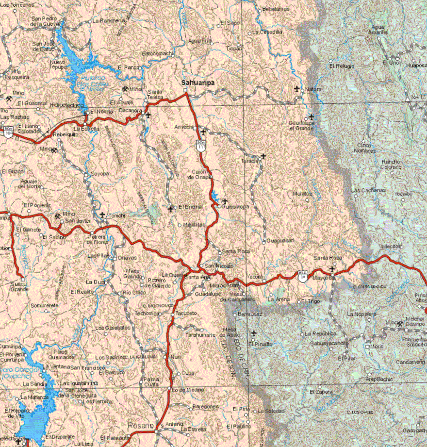
Huapoca Canyon
Ciudad Madera, located in the Huapoca Canyon, is accessible from Chihuahua City by car or bus via the Cuauhtémoc Highway and Highway 16.

In the Huapoca Canyon are found impressive ruins of past cultures - the Cueva del Puente, near Cuarenta Casas, holds dwellings dating from over 800 years ago. Cuarenta Casas itself, or the Cueva de las Ventanas, is a gathering of 15 adobe dwellings constructed about 1000 years ago, protected by a looming overhang of rock. The Paquimé (Magallón) Group of caves lies about 33 km west of Cd. Madera - there, after a fairly tough hike, you can view a number of cave abodes in excellent condition. Other cave dwelling sites in the Huapoca Canyon are located at Cueva Grande and La Ranchería.

Huapoca is also host to the remains of various Haciendas: The Ex-Hacienda Nahuérachi, 10 km. from Madera; what remains of the Ex-Hacienda Sirupa, some 50 km from Madera, is now only just a shell; and Ex-Hacienda San José de Bahicora, which was one of the most extensive in the country, is located 60 km east of Madera. It was once owned by William R. Hearst.

Huapoca Canyon envelops some great trout lakes: Peñitas Lake, near Madera on the La Norteña highway, offers boat trips and fishing. There is also a trout farm for the purchase of fresh fish. Cebadillas Lake is located near Cebadilla de Dolores, what is now almost a ghost town 90 km from Madera.
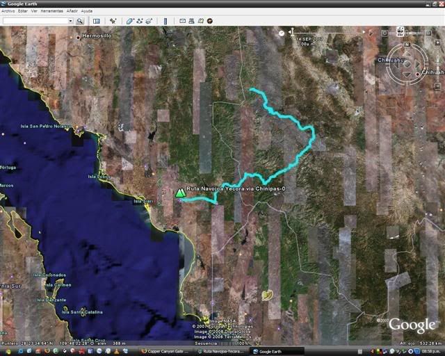
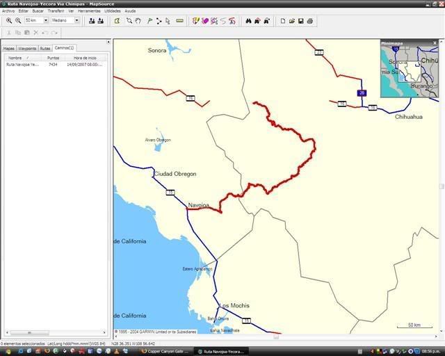
The Oteros and Chinipas Canyons
One of the least explored areas, the Oteros and Chinipas Canyons form one of the longest canyon systems in the region. They are accessible from Creel and Divisadero, via the mining town of Manguarichi or through the town of Uruachi. Near Uruachi, in the Otachique valley, is the Cave of the Mummies where three mummies and their related burial artifacts were found. The Las Estrellas valley holds a number of caves with dwellings constructed in the Paquimé style. Unusual rock formations that give the impression of a labyrinth are found in the Otachique Valley at Los Altares.

At the bottom of the Oteros Canyon is a small community called La Finca, with a hanging bridge over the river and adobe dwellings surrounded by fruit orchards laden with mangos, citrus, papaya and avocado.

The Missions of the area include the Santa Inés de Chinipas Mission, Santa Teresa de Guazapares and Santa María Magdalena de Temoris. The town of Chinipas is an excellently preserved mining town with 19th C adobe architecture and an aqueduct which is no longer in use.

At Palmarejo, near Chinipas, mines are still functioning and the Nuestra Señora del Refugio Temple is worth a visit. Maguarichi, a town founded in 1749, is now practically abandoned. In it are found the Santa Barbara Temple (18th C), an old hospital and several other two-storey buildings of typical adobe construction.

Etiquetas:

jueves, 10 de enero de 2008

Alot of people had asked me for maps.


You need maps?, i got some heavy, printable, detailed maps.

They are from Mexico´s SCT (Secretaria de Comunicaciones y Transportes), PDFs with great detail, they have most, but not all of the backroads, What they do have is most of the communities, and that helps, they dont have the Mythical Choix-El Sauzal road (Too new, I guess) which connects Choix-Tubares-Piedras Verdes-Mesa de Arturo. It does exists I promise, its just not on the maps :-(

I hope you enjoy them.

Chihuahua PDF Map 1:720,000

Sinaloa PDF Map 1:510,000

Sonora PDF Map 1:770,000


Saludos

Etiquetas: , ,

miércoles, 9 de enero de 2008

We are putting together a route to Yecora´s Mesa del Campanero


We decided yesterday to try to cach some of the snow that falls on La Mesa del Campanero near Yecora, so expect a detail trip report and GPS route.

Thats part of the harder route I talked about before, but this time we are going to get there the easier way :-(

La Mesa del Campanero is Yecora´s main hunting and agricultural zone with more than 1,300 tons of apples and apricots per year, plus some nice Wild Turkey hunting later on the season.

Some links of the region,

Yecora General Info

More links coming soon ...

Etiquetas: ,

martes, 8 de enero de 2008

Choosing you route, Route C, Going from Obregon To Yecora


Of the 3 main routes that you can use (Coming from the Pacific coast) this is the only one that is viable for explorers with heavy RVs and/or 2WD. There is also a hard subroute for those seeking an unforgettable experience (And with rigs to match).

The paved route starts in Esperanza, Sonora, About 8 miles north of Cd. Obregon, Sonora.

From Esperanza you start driving on State Road 112 to Rosario de Tesopaco, after 1.5 hours you will get there, its a good place to fill up, (And ask where you can get Bacanora, a mean but very good local tequila), as you continue up the mountains in 1 short hour you will reach a junction for the main road from Hermosillo to Yecora (Road Mex 16), you turn right to Yecora and 45 minutes later you will reach a nice port called Mesa del Campanero, it has a nice small restaurant with some good Machaca (Dryed Beef). From there its a short drive to the valley of Yecora down below.

The roads are usually bad after the rains in September and beyond Rosario de Tesopaco are tipical twisty sierra roads, on winter, sometimes there is ice on the roads and no one to tell you about it, so be careful.

In Yecora you can find several small basic hotels and some Cabañas for larger groups, just ask at the Pemex station at the entrance of town, in later years it has become somewhat of a ´hot town´ but as long as you dont wander alone at night should be ok.

Etiquetas: , , ,

lunes, 7 de enero de 2008

Choosing your route ...


So you want to cross the Chinipas river in Late summer?

Thats how a bunch of jeeps on 35s tires looked like last September, it was fun !!!

Today, I will start with a map and a quick listing


Today, i'll start with a map and a quick listing of the bigger towns in the area, most of the dirt roads on the region connect this towns, some are well known but most of the new ones are not in maps yet.

I will cover only the roads north of El Fuerte, you can certainly go up the sierras from Culiacan and Guasave/Sinaloa de leyva but its considered risky and I woudn´t recommend it.

Lets start ...

There are 3 main routes up the sierras, I will describe them in detail in the coming days, for now lets just do a quick list of each one.

Route A : LOS MOCHIS-EL FUERTE-CHOIX-TUBARES-PIEDRAS VERDES-MESA DE ARTURO-CEROCAHUI-BAHUCHIVO-CUITECO-SAN RAFAEL-DIVISADERO-CREEL.

Route B: ALAMOS-SAN BERNARDO-CHINIPAS-TEMORIS-MESA COLORADA-BAHUCHIVO-CUITECO-SAN RAFAEL-DIVISADERO-CREEL.

Route C: OBREGON-YECORA-BASASEACHI-SAN JUANITO-CREEL.


You will notice that some well known places are not on the routes, like Batopilas or Urique, I will get to them later on, after I describe the above routes in detail.

Saludos

Etiquetas: ,

domingo, 6 de enero de 2008

Where is what?, How fast can I get there?


Most people i know try to learn about the location of a place just to get there and don´t really learn much about how it was founded, or why it even exists.

I will try to provide information on the different places along the way and what they represent from severals points of view. Hopefully you will have a much nicer time when you get here, and leave with a better understanding of the place.

The following link gives a pretty good explanation of the start of the Railroad proyect and the foundation of what will eventually become Los Mochis Topolobampo or Bust

Additional information can be found on the following links:

Owen snnipet from the New York Times 1902

The Register of Topolobampo

Another View

Los Mochis Wikipedia entry


Etiquetas: ,

sábado, 5 de enero de 2008

A quick introduction


Los Mochis its the starting point of the ChePe, the famous rail road that crosses the Tarahumaran Sierras, a really nice engineering marvel that crosses 39 bridges and through 87 tunnels as it climbs from sea level to over 8,000 feet at the sierras.


What is not as widely known its the trails that crisscross the region and can be used for nice overland expeditions in a 4x4 vehicle, next week I will start documenting some of those travels, that take us across lost roads, deep rivers and some unexpected adventures.


Saludos

Etiquetas:

The start of Copper Canyon Gate


After a nice afternoon with my friend George and his Blog, I have decided to start my own, I will document the area of the Copper Canyon and its entrance at Los Mochis, Sinaloa, I hope to provide information of the area to fellow travelers and expeditioners from all over the world.

Saludos.

Etiquetas: , , ,